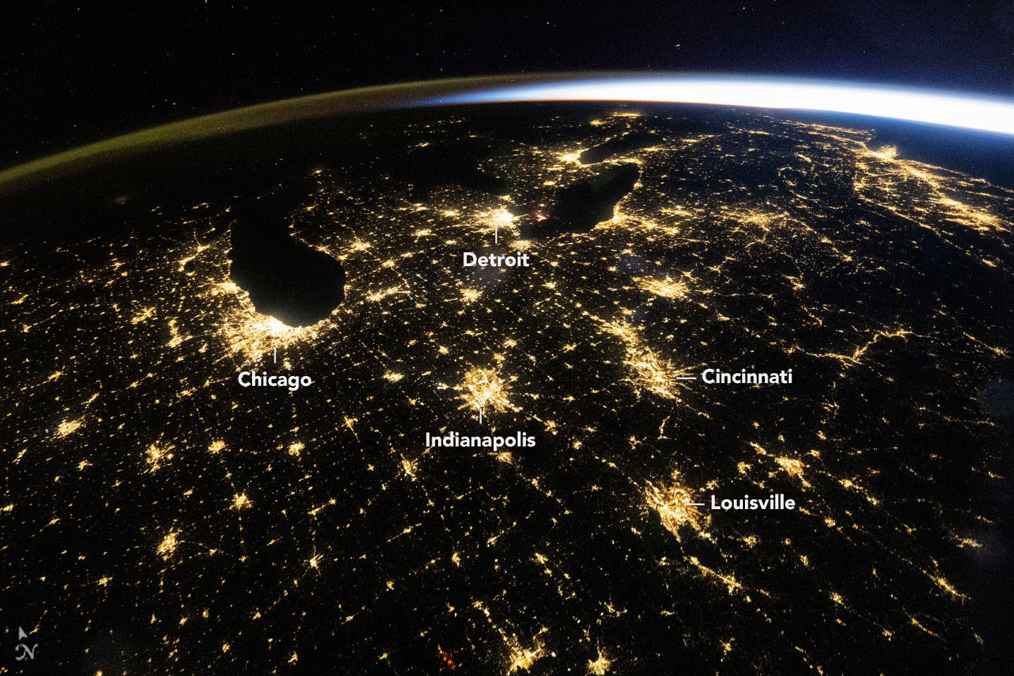
A photograph of the American Midwest looks almost like a road map drawn in light. Chicago stands out on the shore of Lake Michigan. Smaller points shine between the major cities. On 4 November NASA published an account of what an astronaut could distinguish in this view from the International Space Station, and what a closer look at just one city adds.
The wide view records a particular moment. At 09:54 UTC on 18 October it was 4:54 in the morning in Chicago. The sky was mostly clear. Sunlight was already visible along the horizon from the station, although people in Chicago still had about two hours to wait for sunrise.
Light in the picture comes from more than one place. The bright concentrations on the ground include Detroit and Cincinnati, and strings of lights trace roads between cities. A faint green and orange band follows the curve of the Earth. That glow comes from the upper atmosphere, well above the streets.
To see what distance conceals, compare the two cameras' fields of view. The October photograph was taken at a focal length of 14 millimetres. A second astronaut used a 400-millimetre lens on 1 March 2024. In the wide frame Chicago is a pale yellow patch. At the finer scale, lights of several colours can be distinguished.
The dates matter as much as the lenses. These two photographs explain a difference in detail. They are a poor basis for deciding whether Chicago gained lights between 2024 and 2026. For tracking change, NASA also produces its Black Marble series from satellite observations, with records covering days, months and years.
What it means for you. When an image from orbit is shared as evidence of a power cut, look for its capture time, the area it actually shows and a comparable view taken earlier. A bright patch may contain many different streets. A single wide photograph cannot establish which homes had electricity.