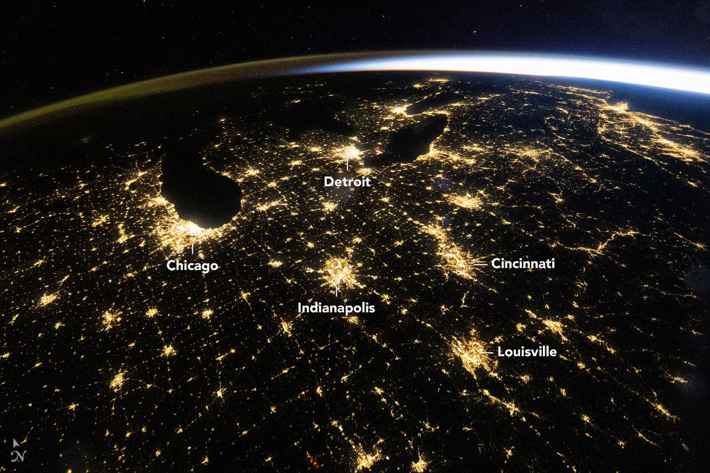
One picture of di Midwest for America look almost like road map wey dem draw with light. Chicago stand out beside Lake Michigan. Smaller lights shine between big cities. On 4 November NASA explain wetin astronaut fit pick out from di International Space Station for dis picture, and wetin person fit see if e look closer at just one city.
Di wide picture catch one particular moment. At 09:54 UTC on 18 October, na 4:54 for morning for Chicago. Cloud no plenty. From di station, sunlight don show for where sky meet earth, even though Chicago people still get about two hours before sun go rise.
No be one place all di light come from. Among di bright places for ground na Detroit and Cincinnati. Lines of light follow roads between cities. One faint green and orange band follow di curve of di Earth. Na di upper part of di atmosphere produce dat glow, far above di streets.
To see wetin distance fit hide, compare how wide each camera fit see. For di October picture, di lens focal length na 14 millimetres. Another astronaut use 400-millimetre lens on 1 March 2024. For di wide picture Chicago look like one patch of pale yellow. For di one wey show more detail, person fit see different colours of light.
Di dates matter just like di lenses. Di two pictures explain why detail fit differ. Dem no give enough evidence to decide whether Chicago get more lights between 2024 and 2026. To track change, NASA still dey use satellite observations to produce di Black Marble series, with records for days, months and years.
Wetin e mean for you. If person share picture from space as evidence say light go off, check when dem take am, which area e show and whether earlier picture dey wey you fit compare with am. Plenty different streets fit dey inside one bright patch. One wide picture alone no fit tell you which houses get electricity.