In one view of the Pacific late in October, two storms looked as though they belonged to different planets. A tight circle of cloud sat near the Mariana Islands. Farther north, a long sweep of cloud curled towards Alaska. On 3 November NASA Earth Observatory explained how satellites had captured two different stages of a storm’s life.
The wide view came from the EPIC camera aboard the DSCOVR satellite on 29 October. The round storm was Super Typhoon In-fa. The northern clouds included the remnants of Typhoon Champi, which had already changed character as they reached the storm track over the Bering Sea.
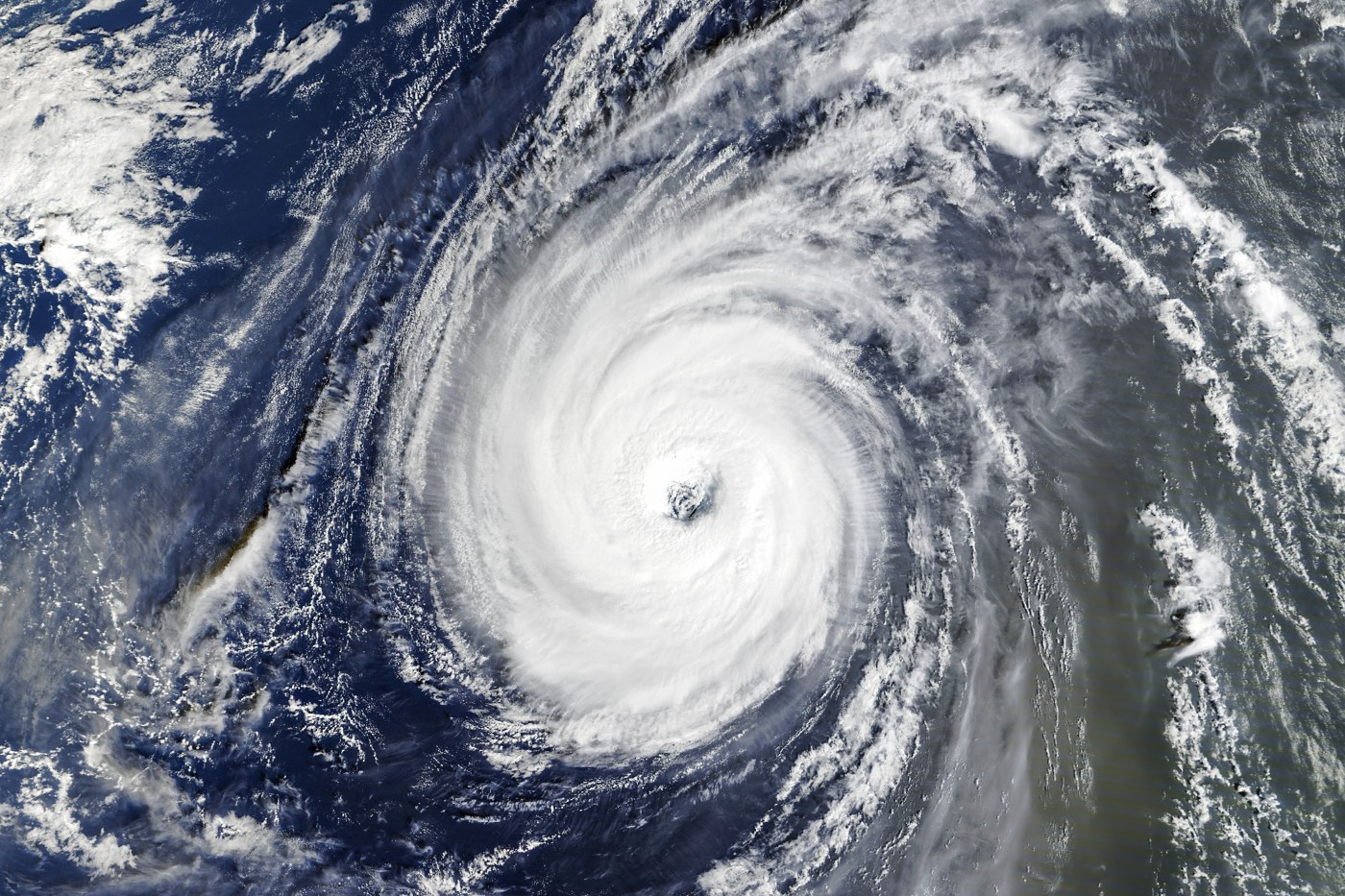
A day later the MODIS instrument aboard NASA’s Terra satellite captured a closer view of In-fa west of the islands. The broad eye stood out inside an almost circular ring of cloud. The prominent spiral bands that often stretch out from tropical cyclones were largely absent. Meteorologists call storms with this combination of features annular.
The same description would have missed what was happening farther north. Tropical cyclones draw energy from warm water and have a warm core. A storm outside the tropics can draw energy from the contrast between neighbouring bodies of warm and cold air. Champi’s remnants had undergone that transition.
As the system changes, the reach of its winds can grow. That does not necessarily mean the winds at any one point have increased in speed. NASA meteorologist Gary Partyka said a storm would probably have formed over the Bering Sea anyway, but Champi’s remnants appeared to have helped it intensify.
What it means for you: when a satellite image circulates with a storm’s name, check the observation date and what stage the storm was in. These photographs document conditions on 29 and 30 October. They explain the cloud patterns over the Pacific and do not give a forecast for Nigeria.