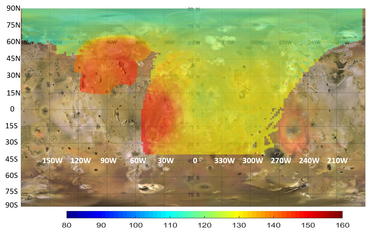
A NASA map published on July 22 shows how the Juno spacecraft investigated heat beneath the surface of Jupiter's moon Io. This archive analysis concerns microwave observations, which probe a different layer from infrared instruments that measure the temperature at the surface.
Juno's Microwave Radiometer used low-frequency channels at 0.6 and 1.25 gigahertz. NASA says these measurements can penetrate roughly two to six metres into the crust. The result is a temperature map derived from radiation, not a photograph exposing rocks beneath transparent ground.
A prominent warm anomaly lies between about 60 and 120 degrees west longitude. The measured subsurface temperatures there are around 10 to 20 Celsius degrees above surrounding areas. This is a difference in temperature; it does not mean the entire region sits at 10 to 20 degrees Celsius.
The anomaly coincides with the Zal Montes Patera complex, where another Juno instrument observed an active lava flow. A second broad heat source appears near the equator, across approximately zero to 50 degrees west longitude. Together they point to substantial local internal heating.
The map combines observations from close passes on December 30, 2023, and February 3, 2024. Their footprints overlap because Juno spun twice per minute while passing roughly 1,500 kilometres above Io. Both passes sampled the side that continually faces Jupiter.
Colours make the variation easier to compare, but they must be read as a scientific scale. The evidence adds depth to the picture of Io's volcanism by distinguishing warm subsurface regions from colder surroundings, rather than treating every bright surface feature as the same kind of heat source.